Student Map
Data mapping tool for viewing students, schools & catchment zones. Great for student assignment, enrollment monitoring, and school boundary analysis.
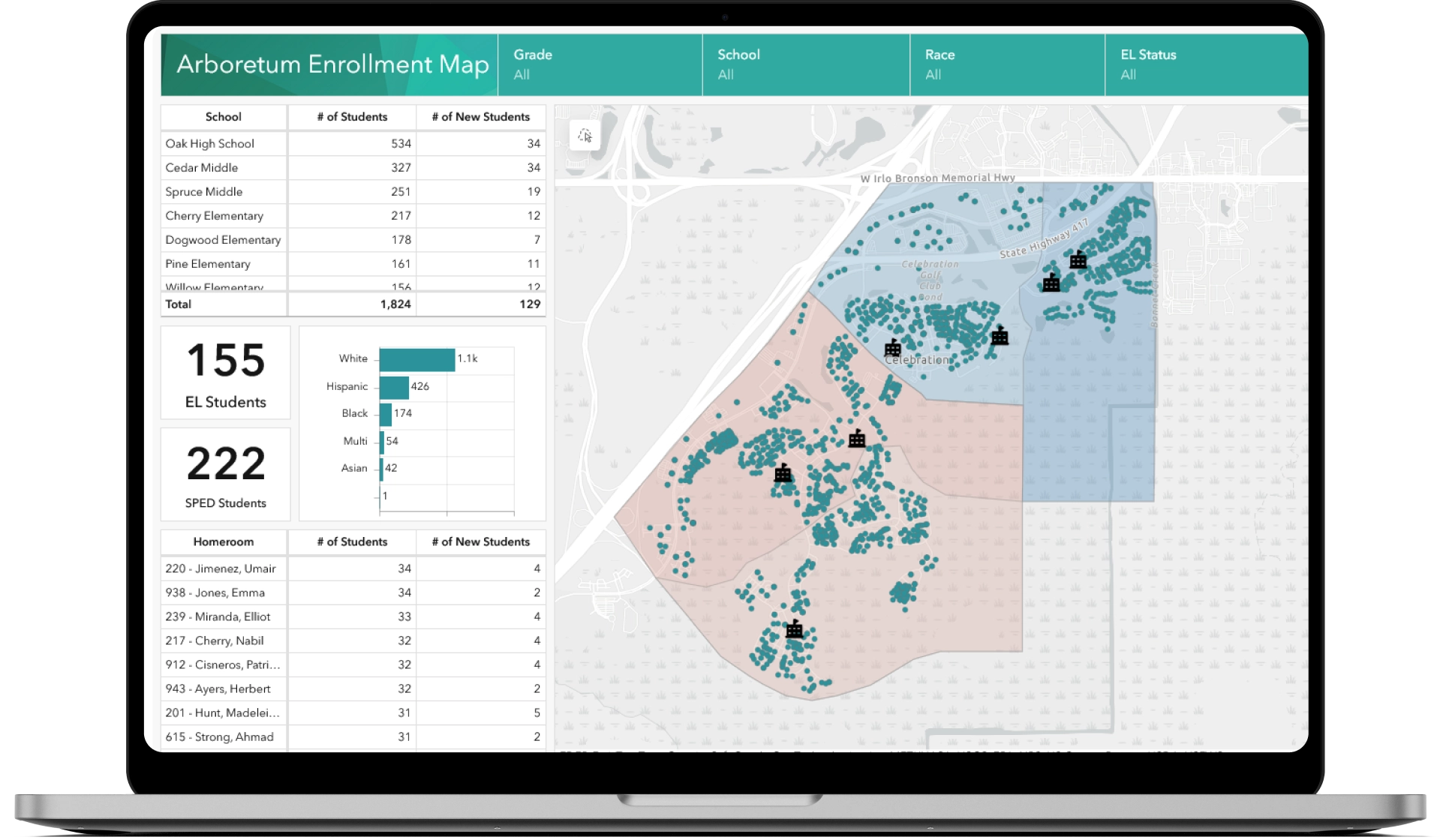
Our student map allows you to see your school district in an entirely new way. By mapping the location of your district’s schools, catchment zones, and students, you can use this tool to answer important questions around school zones, new student placement, and more.
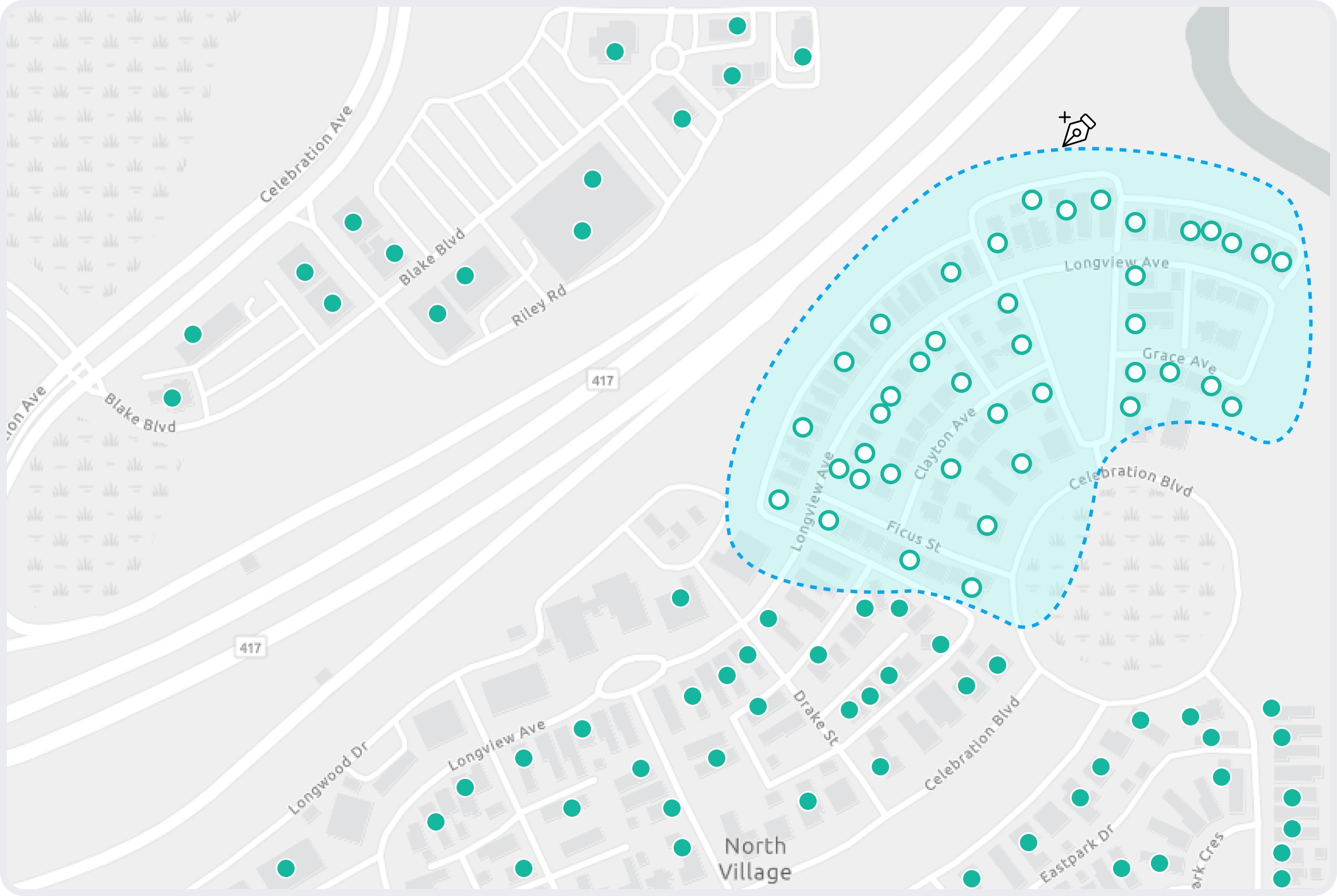
The lasso select tool allows you to select entire neighborhoods of students at the same time. The dashboard graphs allow you to see how many students are contained within the selection, in which schools they are enrolled, and key demographic data.
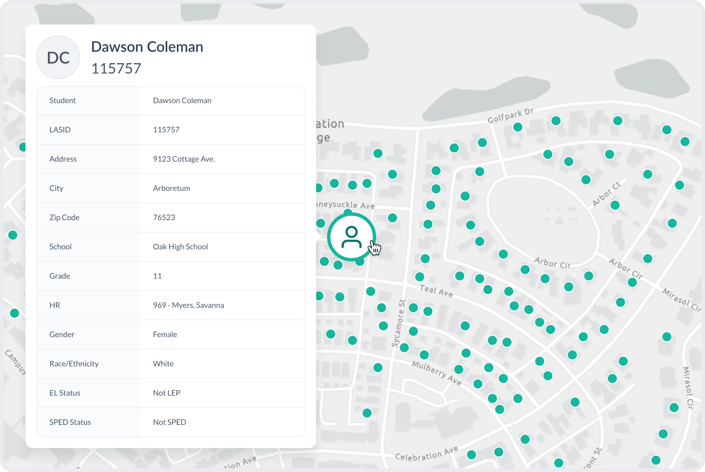
Each student within your district is added to the map and can be viewed simply by clicking on the corresponding dot. If students in a certain neighborhood need to be notified of an issue, you can use the map to quickly put together a contact list.
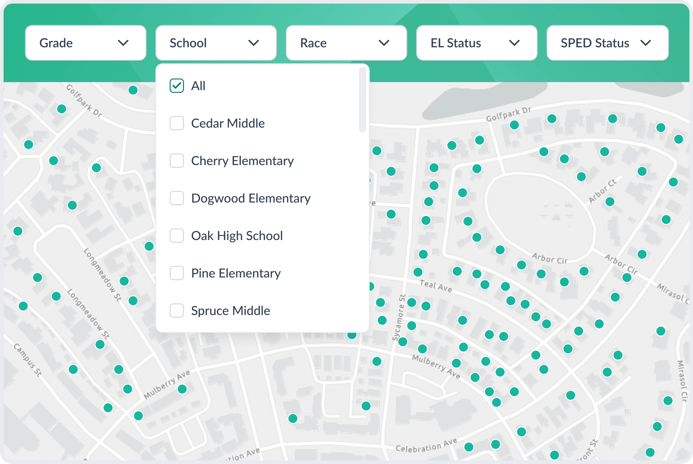
We include a robust panel of filters for grade, school, entry date, and other demographics so that you can adjust your view accordingly.
We are able to geocode your students based on their physical address stored in your SIS. There is no extra work needed on your end.
If your organization doesn’t already have your zones mapped digitally, we can create the zones for you.
Filter by school, grade, entry date, and demographic attributes to adjust which data you see in the map.
The lasso tool allows you to select all students within whatever geographic boundary you draw.
You can export any of the data tables within the map dashboard to csv.
Our maps are powered by ArcGIS, one of the most trusted geographic information systems in the market.